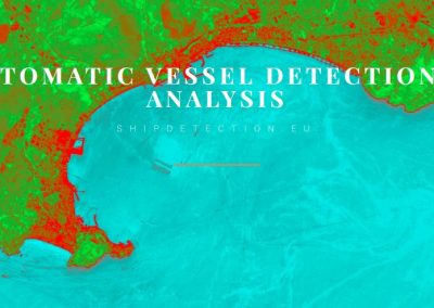
Sustainable data-driven fishing in high latitudes
An end-to-end data analytics solution for precision fishing that optimizes fishing and navigation operations in Polar regions
Problem (1)
Fishing is uncertain, risky and expensive
Fishing in the open sea is challenging: competition is heavy, operating costs are high, and there are often severe weather conditions to contend with. Current solutions for identifying fishing grounds are static and slow, and route optimisation is rarely used.
Problem (2)
Climate change makes precision even more important
The changing climate means that fish stocks are moving, which means that precisely locating them is becoming even more pressing. In addition, fishers lose money through unintentional by-catch of e.g. dolphins, marine turtles and seabirds.
Solution (1)
Data-driven identification of the best fishing grounds, with route optimisation
Polaris enables fishermen to dynamically locate optimal fishing grounds – both for target species and to avoid sensitive bycatch species, and to chart optimal routes between fishing grounds and/or ports

Solution (2)
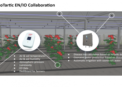
Data is part of the catch
As part of the POLARIS system, temperature and salinity sensors are attached to fishing gears to measure ocean conditions at depth. The in situ data collected in this way work in synergy with satellite data to identify fishing locations. An added benefit is that the data are sent back to the regional ocean forecasters, improving forecasts exactly where the fishers are active.
Go further
Learn more about the activity of the creators of this projects through their websites


Other projects in the Food sector


![]()
This website is part of PARSEC Accelerator
![]() This project has received funding from the European Union’s Horizon 2020 research and innovation programme under grant agreement No 824478.
This project has received funding from the European Union’s Horizon 2020 research and innovation programme under grant agreement No 824478.